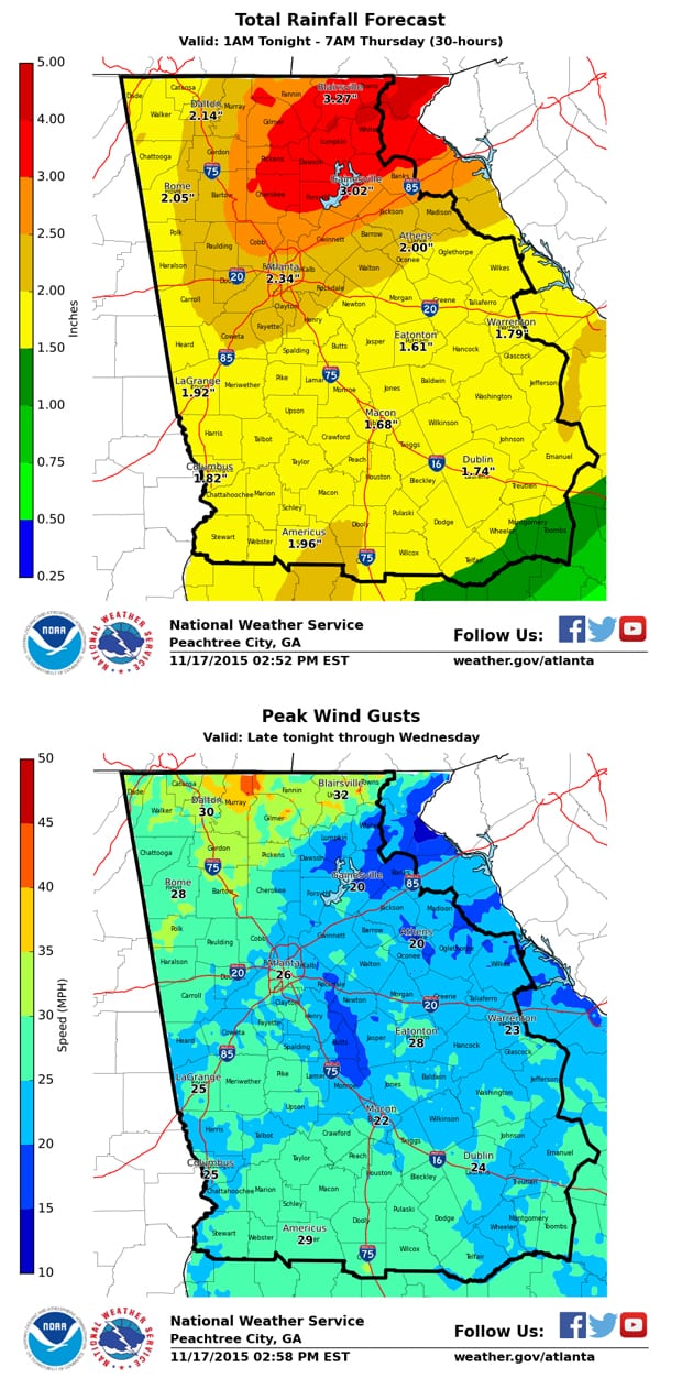
Here’s an UPDATE on impact weather expected to affect north and central Georgia late tonight through Wednesday evening, as of 3:30PM EST Tuesday (November 17).
Changes from previous forecast (yesterday):
1. The heaviest rain associated with a broken “squall line” of showers/thunderstorms is expected to be about 3-6 hours slower than thought yesterday. This will place the axis of heavy rain entering northwest GA between 12PM (noon) and 3PM Wednesday. The heaviest rain should exit our eastern/southern-most counties after midnight, Wednesday night.
2. We are also expecting slightly higher total rainfall amounts (see attached graphic), especially across northeast Georgia where 3-4 inches of rain is possible.
Hazards (WATCHES/ADVISORIES/ETC.)
** FLOOD WATCH in effect from 10AM Wednesday through 10AM Thursday
** WIND ADVISORY in effect from 10PM Tonight through 1PM Wednesday
Primary Threats/Impacts/Timing:
Confidence:
Image Attachments:
Jasper, Ga -- The AAAA State Softball Tournament began on Wednesday, October 14th as teams…
Jasper, Ga -- It turned into a windy and rainy night on Friday, October 9th…
Arrest report and photos provided by the Pickens County Sheriff’s Office. The Georgia Open Records…
Gainesville, Ga -- With the non-region schedule behind them, the Pickens Dragons turned their attention…
Arrest report and photos provided by the Pickens County Sheriff’s Office. The Georgia Open Records…
PICKENS COUNTY, Ga. - An online threat directed at Pickens High School prompted a soft…